GIS Symposium 2024
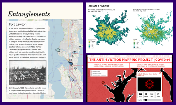
Get Inspired! These student projects used different mapping technologies to document housing injustice, trace the history of Asian migration on Coast Salish Lands, and illustrate the impact of climate change on Mt. Rainier! See these and many more past presentations to learn how GIS mapping is used at UW! See more examples by clicking the image above.
GIS Symposium 2024
Thursday, May 30th
10 AM - 1 PM, Allen Library Research Commons
About
What is GIS?
A geographic information system (GIS) is a system that creates, manages, analyzes, and maps all types of data. Layering different types of data and images, these maps can illuminate issues and trends that are driven by geography, socio-economic factors, the environment and more. StoryMaps and different types of digital mapping technologies such as remote sensing and data visualization technologies are all tools we can use to “connect the dots” in our research stories.
About the Symposium
The eighth Annual University of Washington GIS Symposium will be held on Thursday, May 30th in the Allen Library Research Commons.
The GIS Symposium highlights and celebrates the transformational role of Geographic Information Systems (GIS), remote sensing, and data visualization technologies at the UW and beyond. The event will feature short talks from the UW GIS community followed by a keynote presentation on our new Planet.com resource.
Give a Presentation!
This event invites students of all levels and experiences to share their unique mapping projects to help inspire and educate our UW community about the many different ways this technology can be used to highlight research work and impact. Submit a proposal to present a talk here.
Each presenter will give a very brief “lighting talk” (around 5 minutes) explaining and sharing their mapping work. Participating in the Symposium makes a great addition to your resume, and all presentations will be included in the UW GIS Symposium Proceedings, which are published to UW Research Works! Projects from all disciplines and subjects are welcome.
Watch and Learn
Even if you aren’t presenting, all are welcomed and encouraged to attend the event and reception, and to learn more about all of the great GIS mapping work, tools and tech being used at UW and beyond! Register to attend here.